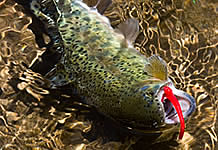
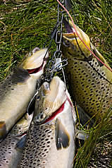
If fly fishing is your passion, Hope Valley and the Carson Pass area will be your paradise. There is no shortage of fishing opportunities here. The wild West Fork of the Carson River - a very accessible river since it's entire length is along Highway 88 or the Blue Lakes Road - and numerous alpine lakes are stocked with rainbows, browns and cutthroat that are waiting for you to cast a fly. A California fishing license is required for anyone 16 years of age and older, available online, at the Markleville General Store and at Woodfords Station.
Fishing Guides
Alpine Fly Fishing Service, 2705 Lake Tahoe Blvd., South Lake Tahoe, California, (530) 541-8208, www.tahoeflyfishing.com/
Horse Feathers Fly Fishing Service, 530-694-2399
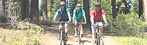
In the Lake Tahoe/Hope Valley/Carson Pass/Markleeville area, 62 trailheads are waiting for hikers and mountain bikers, many of them for both. The trails starting from these heads range from easy walks to expert grade hikes and drives, from short trips of only a few hours to multi day excursions. They are too many to list all of them here. However, to whet your appetite a few of them are shown. For more information about hiking and biking in this area please consult the Alpine Sierra Trailblazer.
Name of Trail
Brief Description
Hike
Bike
Rated
One-Way Distance
Map
Big Meadow / Carson Pass
Southern trailhead is at Carson Pass, Hwy 88; northern trailhead is on Hwy 89 at a parking lot near Big Meadow Creek, about 2 miles northwest of Luther Pass.
Begins on Hwy 89 at the parking lot near Big Meadows Creek, about 2 miles northwest of Luther Pass. Ends at Freels meadows. This trail is part of the Tahoe Rim Trail.
Begins and ends at the Woods Lake Campground. Loop includes Winnemucca and Round Top Lakes. Drive west from Carson pass and turn left onto a forest road after 1 mile. Follow that road for one mile to the campground.
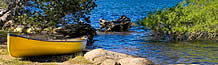
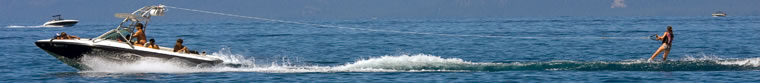
Kayaking in Hope Valley and adjacent areas is possible on many of the scenic lakes as well as on a 4 mile section of the wild Carson River West Fork between the Hope Valley Campground and Pickett's Junction. Lake Tahoe offers 191 square miles of prime boating and kayaking, surrounded by 10,000 foot snow topped mountain ranges. Gear rentals and guided tours are available at the following places.
Action Watersports, 3411 Lake Tahoe Blvd., South Lake Tahoe, California, (530)-544-5387
Kayak Tahoe, 3411 Lake Tahoe Blvd, South Lake Tahoe, California,(530) 544-2011
Ski Run Boat Company, Lake End of Ski Run Blvd., So. Lake Tahoe, California, (530) 544-0200
The East Fork of the Carson River is not only the longest undamed river in the Eastern Sierra Nevada, it is also the most scenic one. Its class I and II rapids make it ideal for beginning whitewater rafters, but experienced veterans of this sport are also attracted to this river because of its scenery and the hot springs along the 21 mile run. It begins at Hangman's Bridge in Markleeville and ends at Ruhenstroth Dam near Gardnerville, Nevada.
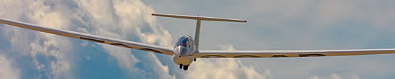
A sightseeing flight over the Sierra Nevada in the Lake Tahoe area is one of the most memorable adventures offered to visitors. Peacefully gliding over the majestic peaks around the world's most spectacular alpine lake in the gondola of a hot air balloon or a sail plane, or actively riding some of the world's greatest thermals with a hang glider or paraglider. Here are some contacts that will set you up for an unforgettable day in the air above the Sierra Nevada.
Nature enthusiasts as well as painters and photographers will be awed by the bounty of unspoiled nature in this remote region of the Sierra Nevada. Besides the often spectacularly weathered and twisted Sierra Junipers, they will wander beneath Jeffrey, White, Lodgepole, Piñion, Yellow, Whitebark, Silver and Sugar Pine trees, or marvel at the colors of Alder, Aspen and Cottonwood trees in Fall.
In late spring and summer carpets of wildflowers cover the mountain meadows, often right next to the highway. Along with the almost omnipresent Lupines and Violets grow Shooting Stars, Tiger Lilies and Monkey Flowers in wet areas, and Pride of the Mountains, many varieties of Paintbrush and Prickley Poppy in dry habitats, to name just a few. Actually, there are so many species of flowers that it is impossible to list them all on this site. The use of reference literature, such as the Audubon Field Guide for Wild Flowers, is highly recommended.
Bird watchers will enjoy sightings of Bald and Golden Eagles, Red-Tailed Hawks and Great Horned Owls any time of the year. Purple Finches, Brewer's Blackbirds, Cliff Swallows, American Kestrels and Turkey Vultures populate the sky mostly in summer. Among the resident critters are the cute and tiny Chipmunks, the cute but not so tiny Black Bears, as well as Mule Dear, Beavers, Raccoons, Porcupines, Mountain Lions and Badgers. As with plants, this list is far from being complete and reference literature is highly recommended.
What are Snow Parks?
Sno-Parks are snow-cleared parking lots which provide winter recreationists with access to popular cross-country ski trails, snowmobile routes, and snow play areas. These sites are undeveloped, without running water and usually a pit toilet.
A permit is required for using Sno-Parks. Daily and season permits are available at the Carson Ranger District office in Carson City, the Alpine County Visitor Center in Markleeville, at Woodfords Station and online.
Sno-Parks near Quail Hollow
Blue Lakes - Located at the junction of Hwy 88 and Blue Lakes Road. Snowmobiling, cross-country skiing, dog sledding and snow play.
Carson Pass - There are two locations on Hwy 88 at Carson Pass. One is located directly at the pass on the south side of the highway, the second one is a quarter mile west of the pass on the north side of the highway. Popular cross-country skiing area, snowmobiles prohibited. Crowded on weekends.
Grass Lake - Located at the summit of Luther Pass on Hwy 89, north of Pickett's Junction. Excellent cross-country skiing, snowmobiles prohibited.
Cross Country Skiing
Camp Richardson Cross-Country Ski Center, Off Hwy. 89 on the way to Emerald Bay, South Lake Tahoe, California, (530) 541-1801
Weather in the Sierra Nevada may change rapidly during all seasons. Elevation - between 4,000 and 11,00 feet in this area - is the major factor for temperatures and precipitation. Conditions may be summer-like in the valleys and more like spring in higher elevations at the same time. Be prepared by wearing layered clothing and keeping raingear handy.
Notice to users: Some pages and pop-up windows on this site contain PDF documents. Your computer needs to have Adobe Reader® installed to display them. In case this program is not installed on your computer you can download it by clicking on the Adobe Reader® icon to the right.
PDF documents may not display in Firefox® and Opera® on Macintosh® computers; instead the browser will give you the option to download the document and display it in Acrobat Reader® or Preview® instead. PDF documents will display as intended if you view this site in the Macintosh® native Safari® browser.
Quail Hollow, 2155 Carson River Road, Markleeville, CA 96120, (530) 694-1155, office@quailhollow.net
Web site design and maintenance by Jens Peermann Creative Services, Carson City, Nevada. All photography by Jens Peermann. All content of this site is protected by copyright laws.
 In the Lake Tahoe/Hope Valley/Carson Pass/Markleeville area, 62 trailheads are waiting for hikers and mountain bikers, many of them for both. The trails starting from these heads range from easy walks to expert grade hikes and drives, from short trips of only a few hours to multi day excursions. They are too many to list all of them here. However, to whet your appetite a few of them are shown. For more information about hiking and biking in this area please consult the
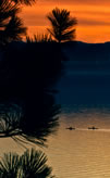
 Nature enthusiasts as well as painters and photographers will be awed by the bounty of unspoiled nature in this remote region of the Sierra Nevada. Besides the often spectacularly weathered and twisted Sierra Junipers, they will wander beneath Jeffrey, White, Lodgepole, Piñion, Yellow, Whitebark, Silver and Sugar Pine trees, or marvel at the colors of Alder, Aspen and Cottonwood trees in Fall.
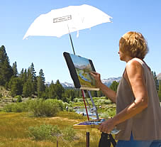 In late spring and summer carpets of wildflowers cover the mountain meadows, often right next to the highway. Along with the almost omnipresent Lupines and Violets grow Shooting Stars, Tiger Lilies and Monkey Flowers in wet areas, and Pride of the Mountains, many varieties of Paintbrush and Prickley Poppy in dry habitats, to name just a few. Actually, there are so many species of flowers that it is impossible to list them all on this site. The use of reference literature, such as the Audubon Field Guide for Wild Flowers, is highly recommended.